

Short-term Warnings
National Hurricane Center Graphics
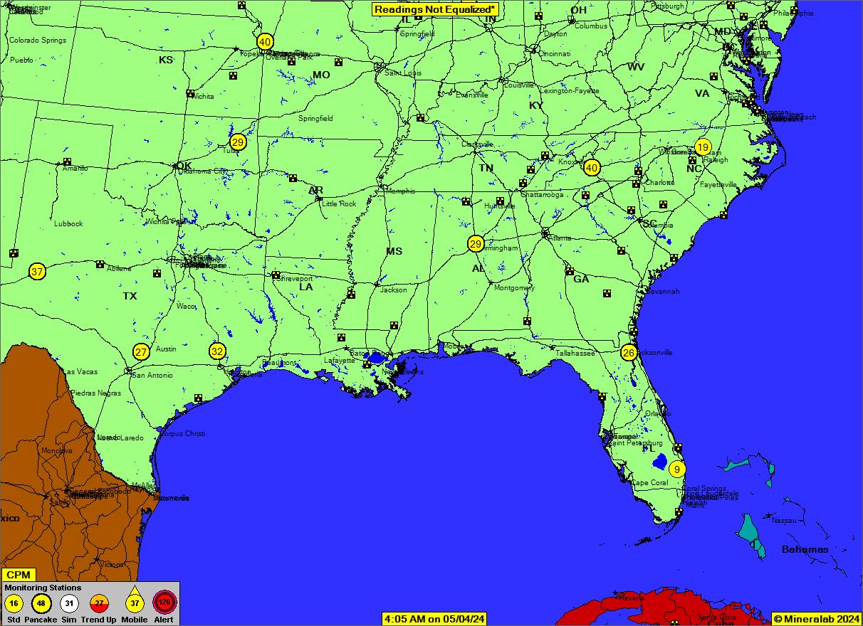
National Radiation Map, depicting environmental radiation levels across the USA, updated in real time every minute. Click on map for details and other radiation-level maps. Refresh page as needed.
Finance
![[Most Recent Quotes from www.kitco.com]](http://www.kitco.com/images/live/t24_au_en_usoz_home.gif?random=0.48760986328125) |
![[Most Recent Quotes from www.kitco.com]](http://www.kitco.com/images/live/au_go_0030_ny.gif) |
![[Most Recent Quotes from www.kitco.com]](http://www.kitco.com/images/live/au_go_0365_ny.gif) |
![[Most Recent Quotes from www.kitco.com]](http://www.kitconet.com/charts/metals/silver/t24_ag_en_usoz_2.gif) |
![[Most Recent Quotes from www.kitco.com]](http://www.kitconet.com/charts/metals/silver/ag_go_0030_ny.gif) |
![[Most Recent Quotes from www.kitco.com]](http://www.kitconet.com/charts/metals/silver/ag_go_0365_ny.gif) |
Tropical Storm Outlook
This product is updated at approximately 1 AM, 7 AM, 1 PM, and 7 PM EST from June 1 to November 30. This map should be disregarded during the non-hurricane season.

Weather

NOAA National Weather Service Storm Prediction Center

Click here for Current Radar

Disaster Alert interactive map.
Interactive event map – The Hungarian National Association of Radio Distress-Signalling and Infocommunications (RSOE) operates the Emergency and Disaster Information Service (EDIS) with the objective to monitor, document and analyze all kind of emergency or disaster events worldwide.